Despite being one of the Lake District’s more impressive caves, it’s somewhat tricky to get to without a little bit of insider-knowledge.
If you follow a sat nav, it’s not clear where to park and start your walk up to the cave entrance. Some routes start from Ambleside, but if you’re looking to shorten the initial walk and get tackling the incline right away – I’ve got just the map for you.
The jagged textures of Rydal Cave
Where to park for Rydal Cave
Pelter Bridge car park is a small gravel car park just on the other side of the bridge over the River Rothay, coming from Ambleside.
It’s Pay & Display, so ensure you have some change to hand. It offers a great starting point for the hike up to Rydal Cave.
From the car park, you can track the left-hand edge of Rydal Water right the way up to the cave mouth.
It’s Pay & Display, so ensure you have some change to hand. It offers a great starting point for the hike up to Rydal Cave.
From the car park, you can track the left-hand edge of Rydal Water right the way up to the cave mouth.
Setting off
Start following the road uphill and to the west. You’ll pass through a small woodland and cottages will line the left-side of the road. Once you clear the treeline, views over Rydal Water will open out the east.
If you wish, you can take a short detour through a gate to your right, head through the trees and see the well-photographed Rydal Water boathouse from across the lake.
If you wish, you can take a short detour through a gate to your right, head through the trees and see the well-photographed Rydal Water boathouse from across the lake.
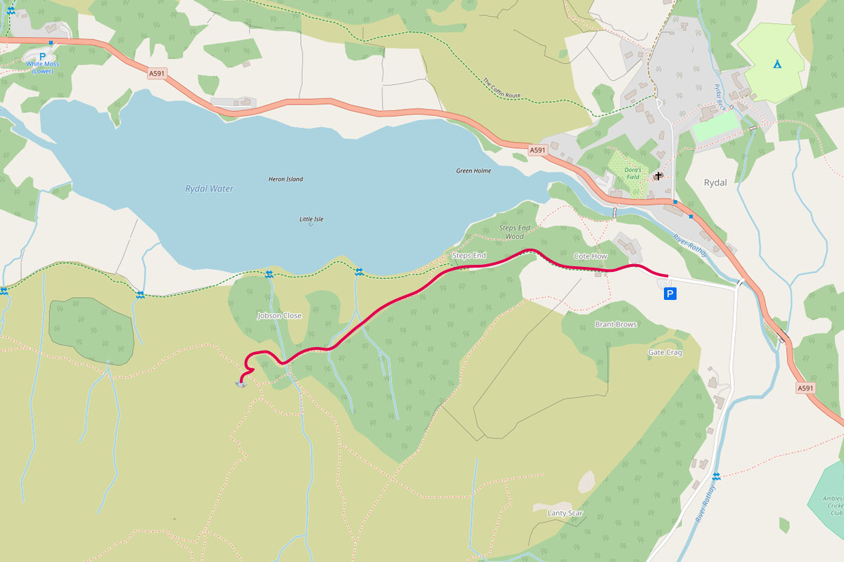
The route up to Rydal Cave, from Pelter Bridge car park
The route and path quality up to the caves
Following the route marked above, it’s a steady but relatively light climb and takes approximately one hour at a leisurely pace. The road gives way to a well established path. Only for the final 5 minutes of the walk does the path break up into a loose slate and stone trail.
If you wish to pause and break up the hike, there’s a viewpoint looking out over Rydal Water once your clear the woodland. You can also head down to the water’s edge and take in the lake.
If you wish to pause and break up the hike, there’s a viewpoint looking out over Rydal Water once your clear the woodland. You can also head down to the water’s edge and take in the lake.
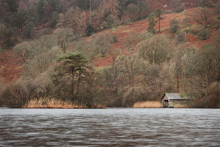
The boat house on Rydal Water
Reaching Rydal Cave
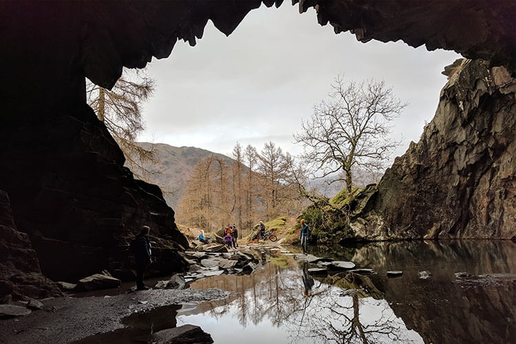
As you round a corner on the loose scree path, the cave system will open out before you. The jagged cave-mouth stands some 30 feet tall and is often partially flooded.
You can access the cave’s main chamber by traversing laid out stepping stones – pausing for a great photo opportunity, of course!
You can access the cave’s main chamber by traversing laid out stepping stones – pausing for a great photo opportunity, of course!
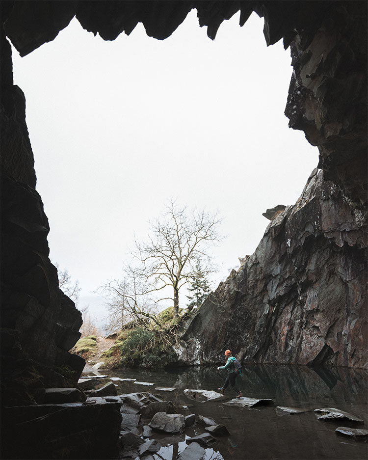
Hopping over the stepping stones
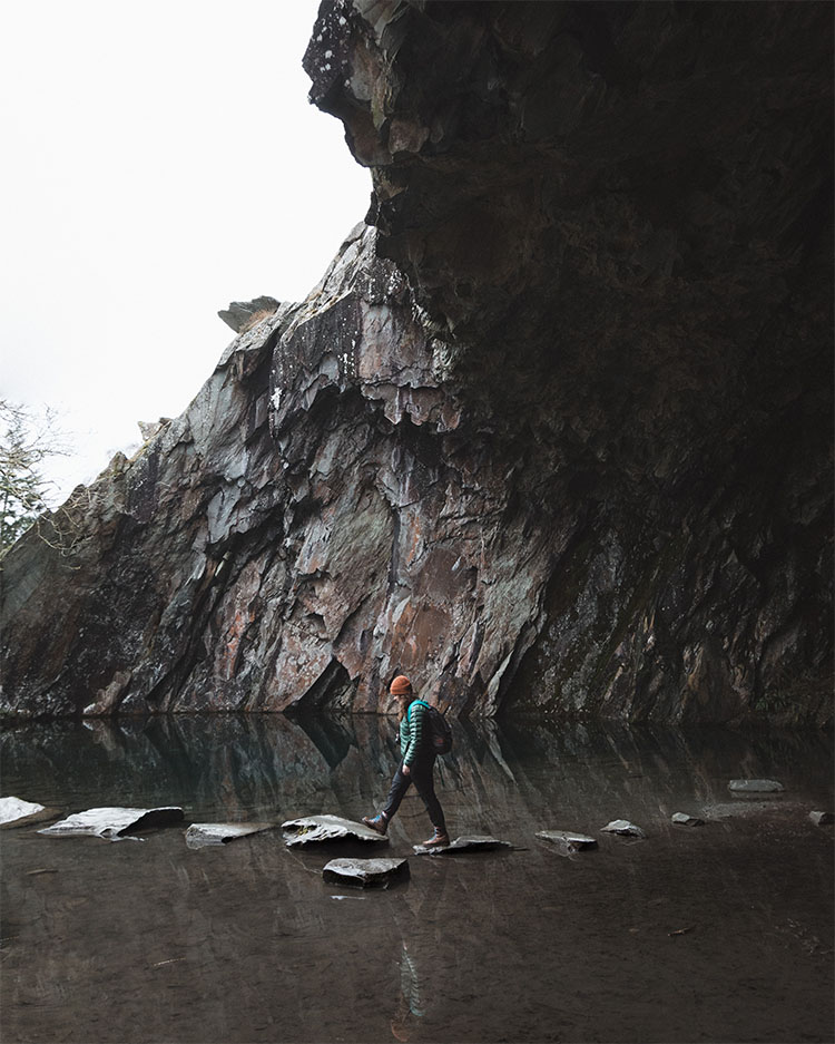
...twice for good measure
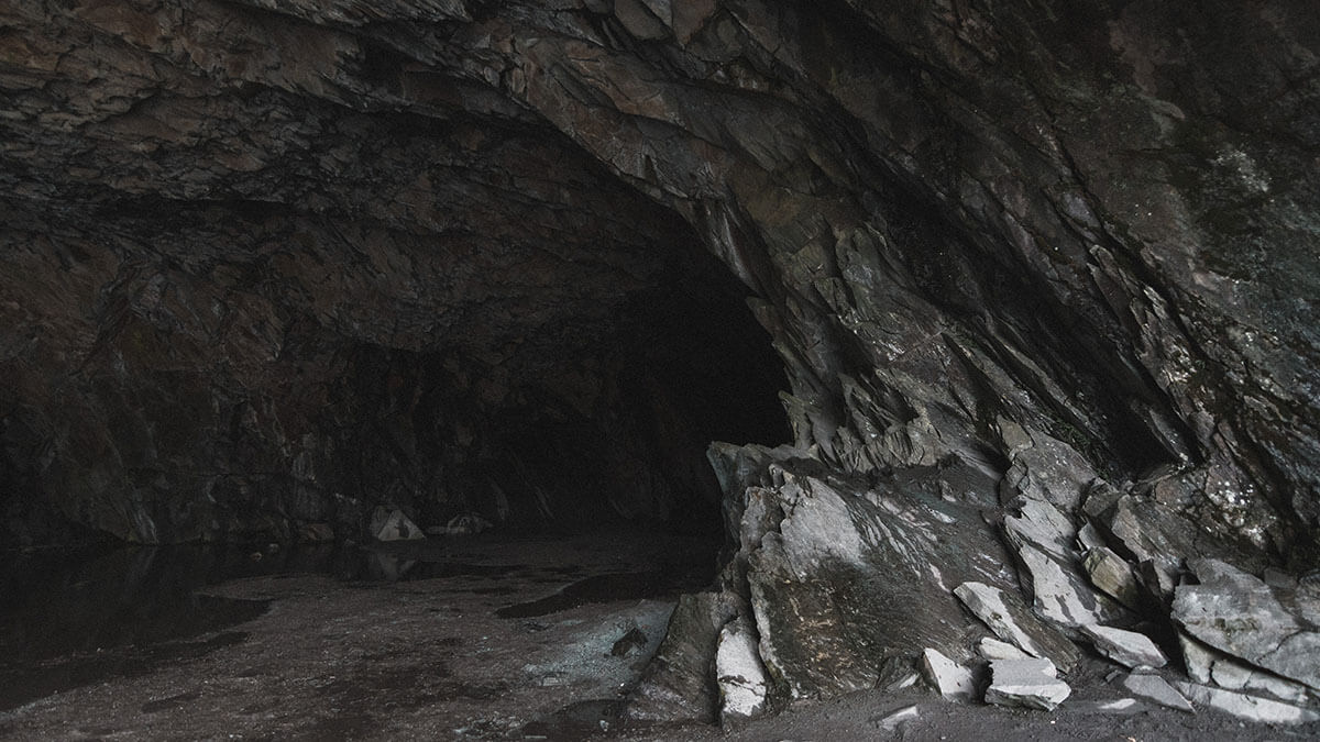
Take the time to explore the full extent of the cave system. The jagged walls are worn smooth by the moisture, and form many interesting and abstract shapes and patterns.
The water that covers the cave floor is vibrant in colour and home to a school of small fish. Near the entrance, the slate walls vary greatly in colour and offer countless interesting compositions and photographic opportunities.
The water that covers the cave floor is vibrant in colour and home to a school of small fish. Near the entrance, the slate walls vary greatly in colour and offer countless interesting compositions and photographic opportunities.
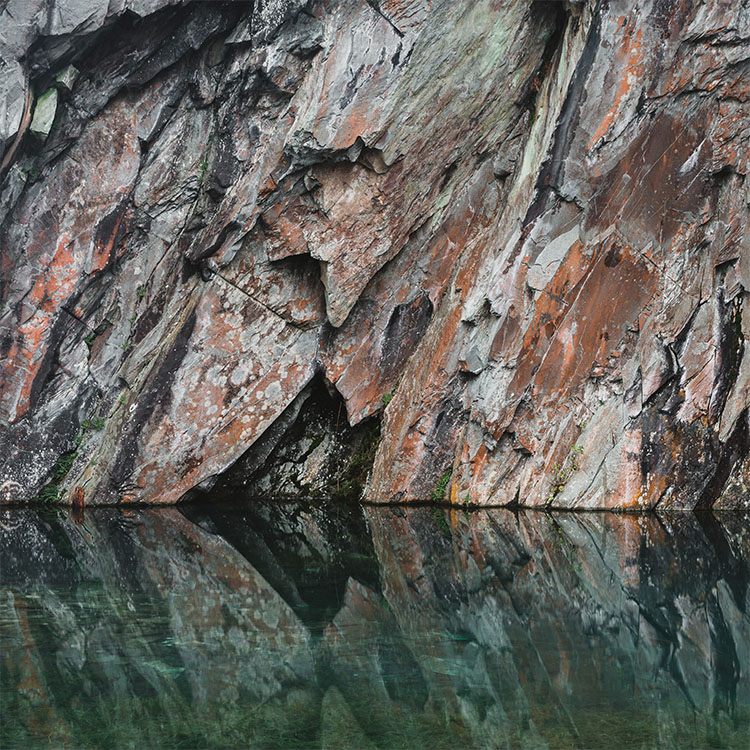
Textures on Rydal Cave's walls
Leaving the cave
Leave Rydal Cave the way you came in: over the stepping stones and follow the same route back to the car park. If you set out for a longer walk, you can follow the path round the Rydal Water circular path or continue up Loughrigg Fell.
That’s it! A quick and simple guide to visiting Rydal Cave. I compiled this for those of you with a short time window, who perhaps want to visit the caves the quickest and most convenient way.
If you visit the cave and follow the route above, let me know and send me your photos on Instagram!
That’s it! A quick and simple guide to visiting Rydal Cave. I compiled this for those of you with a short time window, who perhaps want to visit the caves the quickest and most convenient way.
If you visit the cave and follow the route above, let me know and send me your photos on Instagram!